How Multibeam Echosounders Work
Share
Multibeam Echosounders: Revolutionizing Seafloor Mapping
Introduction
Multibeam echosounders (MBES) have transformed underwater mapping and exploration, providing high-resolution data crucial for scientific research, commercial activities, and environmental management. This article explores how MBES technology works, its applications, and its significance in deep-sea exploration and marine industries.
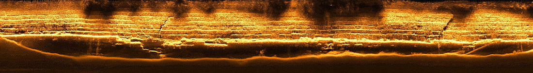
How Multibeam Echosounders Work
Multibeam echosounders use acoustic waves to map underwater terrain by emitting multiple sonar beams from a vessel-mounted transducer. The system records the time it takes for each beam to bounce back after hitting the seafloor, allowing for precise depth calculations and seafloor imaging. Unlike single-beam echosounders, MBES cover a much wider swath, significantly improving efficiency and data resolution.
Key Components of MBES:
-
Transducer Array – Generates and receives acoustic signals.
-
Beamforming Technology – Processes multiple sonar beams simultaneously to enhance coverage.
-
Motion Sensors and GPS – Corrects for vessel motion and ensures accurate positioning.
-
Data Processing Software – Converts raw sonar data into high-resolution bathymetric maps.
For a deeper technical understanding, NOAA provides an excellent guide on MBES systems and their capabilities (NOAA).
Applications of Multibeam Echosounders
MBES technology is widely used in various industries and scientific fields, including:
1. Hydrographic Surveys
Governments and maritime organizations use MBES to create detailed nautical charts for safe navigation, reducing the risk of accidents and groundings (International Hydrographic Organization).
2. Seafloor Mapping and Marine Research
MBES provides high-resolution topographic maps of the ocean floor, aiding marine geologists, oceanographers, and ecologists in studying underwater landscapes, plate tectonics, and habitat distributions (USGS).
3. Deep-Sea Mining Exploration
Companies exploring deep-sea mineral reserves use MBES to locate polymetallic nodules, seafloor massive sulfides, and cobalt-rich crusts before deploying extraction technology (ISA).
4. Pipeline and Cable Route Planning
MBES helps offshore energy and telecommunications companies identify optimal routes for undersea pipelines and fiber-optic cables, avoiding hazards like underwater ridges and faults (Submarine Cable Map).
5. Shipwreck and Archaeological Investigations
Marine archaeologists utilize MBES to detect and analyze shipwrecks, submerged ruins, and historical artifacts hidden beneath the ocean surface. Notable discoveries, such as ancient shipwrecks in the Black Sea, have been made using MBES (National Geographic).
6. Environmental and Fisheries Management
MBES data helps monitor coral reefs, underwater habitats, and fish populations, contributing to sustainable fisheries management and conservation efforts (Marine Conservation Institute).
Advantages of MBES Over Other Technologies
-
High Accuracy: Provides detailed depth measurements and 3D mapping.
-
Broad Coverage: Scans large swaths of the seafloor efficiently.
-
Improved Data Resolution: Offers much finer details compared to single-beam echosounders.
-
Time and Cost-Efficiency: Reduces the need for extensive manual surveys.
-
Integration with Other Technologies: Works seamlessly with ROVs, AUVs, and GIS systems for enhanced data analysis.
Challenges and Limitations
Despite its advantages, MBES technology faces some challenges:
-
High Initial Cost: Requires significant investment in equipment and software.
-
Data Processing Complexity: Handling and interpreting vast amounts of data demand skilled personnel.
-
Environmental Factors: Water conditions such as temperature, salinity, and turbidity can affect signal accuracy.
Future of Multibeam Echosounders
With advancements in AI and machine learning, MBES data processing is becoming more automated, reducing the time needed to generate bathymetric maps. Additionally, the integration of MBES with autonomous underwater vehicles (AUVs) is expanding its capabilities for deep-sea exploration (MIT Technology Review).
Conclusion
Multibeam echosounders have revolutionized the way we explore and understand underwater environments. From hydrographic surveys to deep-sea mining, MBES technology plays a crucial role in various sectors, providing invaluable insights for safe navigation, resource management, and scientific discovery. As technology continues to evolve, MBES will remain a cornerstone of marine exploration and geospatial analysis.
For further reading, you can explore the latest MBES advancements from NOAA, Hydro International, and the International Seabed Authority.