Comparing USV platforms
USVs vs crewed hydrographic surveys: costs, safety and data quality compared
Hydrographic surveys are essential for ports, councils, aquaculture operators and engineering firms who rely on accurate seafloor data. Traditionally these surveys have been carried out by small crewed vessels equipped with multibeam sonar and navigation systems. In the past decade, uncrewed surface vessels have emerged as a realistic alternative for many jobs, especially those that are repetitive or risky for people. Both approaches deliver high-quality results when they are run well, but the differences in cost, safety and workflow are worth understanding before you commission your next project.
What is a USV?
An uncrewed surface vessel is a small, remotely operated or autonomous platform that carries survey payloads without a crew on board. Designs range from large endurance craft capable of months at sea to compact harbour platforms launched from a trailer. Oceanova’s Tawhiri sits firmly in the second category: a 2.4-metre, sail-actuated USV with solar power, Starlink connectivity, autopilot and onboard collision-avoidance. It is sized for semi offshore, coastal and harbour work, where repeatability, access and operating cost matter.
Mission control and autonomy
USVs are defined as much by their software as by their hulls. Oceanova’s BioSYNC platform provides mission planning, real-time telemetry, GIS overlays, sensor control and detection alerts from shore. Operators can see vessel state, environmental conditions and progress along the line plan, nudge waypoints as conditions change and export clean logs for audit.

Caption: BioSYNC mission control showing live telemetry, water conditions and an active waypoint plan.

This kind of mission control brings USVs in line with professional hydrographic expectations, where clients want assurance not only of vessel safety but of reliable data acquisition and traceable processing.
Data quality and instrumentation
A common question is whether a USV can collect data of the same quality as a crewed hydrographic launch. The short answer is yes when the platform carries equivalent instruments and follows the same calibration and QA steps. Tawhiri and small crewed launches both run multibeam echosounders, GNSS/INS navigation and sound-velocity sensors. With a disciplined patch test, sound-speed control and crossline checks, the resulting surfaces, point clouds and contours are indistinguishable.
If you need a compact, survey-grade head, see Oceanova’s product page for the Surveyor 240 MBES, which pairs well with USVs and small launches:
Small hulls can struggle in rough seas and may carry fewer auxiliary sensors than larger launches, but they compensate with precise line-keeping in tight spaces and the ability to repeat missions at low cost.
Cost and operating economics
Crewed surveys concentrate cost in people and vessel time. A safe operation typically requires a skipper and at least one surveyor on board, sometimes more for safety and processing. Day rates rise quickly once travel, insurance and compliance are included.
A USV flips the balance. Capital investment moves into the platform, while operating costs are reduced because there is no crew on board, fuel burn is minimal and missions can be run repeatedly from shore. For small to medium coastal projects and routine monitoring, the per-survey cost often drops markedly. For large one-off areas where a bigger hull can cover ground quickly, a crewed launch can still be more efficient.
Price differences across USV classes
There is a wide spread in acquisition cost depending on mission profile. Endurance platforms are built for oceans and months of operation; compact platforms are built for coastal and harbour work. The table below gives order-of-magnitude figures to help frame discussions. Actual prices vary by configuration and service model.
| Platform | Size / type | Endurance | Typical price (NZD) | Access model | Best use case |
|---|---|---|---|---|---|
| Saildrone | 7–12 m rigid-sail USV | 6–12 months | Multi-tens of millions | Contracted service | Transoceanic research and climate patrols |
| OCIUS Bluebottle | ~6–8 m solar + sail USV | Months | Low-millions | Purchase or lease (defence/research) | Naval ISR, EEZ patrol, coastal defence |
| Tawhiri (Oceanova) | 2.4 m sail-actuated USV | Months | Sub-$300k prototype class | Direct purchase lease (scalable fleet) | Harbour hydrography, biosecurity, monitoring |
| Crewed survey launch | 6–12 m crewed vessel | 1 day per shift | Opex typically $2–10k/day | Charter or owned | Hydro surveys, larger coastal coverage |
OCIUS bluebottle

OCIUS Bluebottle combines solar, sail and wave propulsion for long-endurance missions.
SailDrone

Caption: Saildrone is designed for year-long, open-ocean missions with heavy scientific payloads.
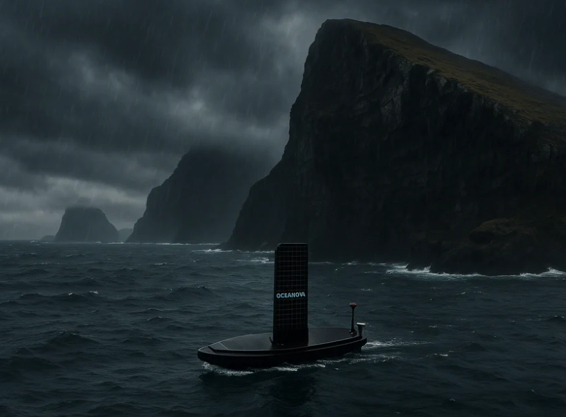
Tawhiri USV

Caption: Oceanova’s Tawhiri, a 2.4-metre sail-actuated USV for hydrography, biosecurity and environmental monitoring in NZ waters.
Where each option fits best
Large-area charting and offshore programmes still lean on crewed launches for sheer throughput and onboard processing. Smaller harbours, marinas and rivers are where USVs shine. They operate quietly for long periods, can enter tight areas without wash, and repeat line plans on a schedule that would be cost-prohibitive with people on the boat. A hybrid model is often the sweet spot: a crewed launch handles transit, logistics and open water, while a USV works under wharves, around piles and inside confined berths.
Practical uses that benefit from USVs
Harbour and marina hydrography benefits from quiet, precise line-keeping and the ability to grid at fine resolution without tiring a crew. USVs enable routine berth-pocket certification, channel maintenance checks and rapid change detection after dredging or storms.
Biosecurity surveillance is another strong fit. USVs can run structured patrols that combine bathymetry with backscatter and video for species detection. The ability to repeat a mission weekly or monthly gives councils a baseline for early warning. BioSYNC’s detection and alerting tools help triage targets for divers and ROVs.
Aquaculture operations use USVs for site selection and farm monitoring. High-resolution mapping of seabed gradients, scour and substrate type reduces risk for new lines and helps schedule maintenance around sensitive habitats. The low operating cost means farms can scan more often and catch changes early.
Rivers and flood response demand quick deployment and safe operation around debris and bridges. A compact USV can be launched from the bank, run multibeam or sidescan in shallow water and keep people out of harm’s way. Repeating the same grid after a flood quantifies scour and sediment shifts.
Infrastructure and asset inspections, such as wharf piles and outfalls, benefit from a combined approach. Bathymetry identifies features, backscatter hints at substrate, and cameras confirm the details. USVs can dwell precisely under structures that are awkward for a crewed boat and gather better angles for the same time on task.
Environmental monitoring is an ongoing need for councils and research groups. USVs carry CTD, turbidity, dissolved oxygen and pH sensors alongside sonar and cameras. The platform’s endurance and remote supervision allow for seasonal campaigns without tying up staff on the water.
Example workflow with BioSYNC
A typical mission begins with a simple line plan drawn against a geofenced area in BioSYNC. The vessel is launched from a ramp or shoreline and takes the first line under autopilot. Real-time telemetry confirms speed, heading, battery and water conditions, while alerts flag weather shifts or waypoint arrivals. On completion the logs, raw sonar and navigation data are synced back to shore for processing. Deliverables usually include a GeoTIFF bathymetry grid and hillshade, a compressed LAS or LAZ point cloud, contours for CAD and a mesh for visualisation. A short QA note lists calibration, sound-velocity casts and crossline statistics so the results are traceable.
Tawhiri’s edge is practicality. At 2.4 metres and sail-actuated, it can be launched from a trailer, slip quietly into tight berths and under-wharf zones, and hold a precise line without wake or fumes. That makes it ideal for harbour grids, outfall checks and biosecurity patrols where larger endurance craft are overkill and crewed launches are expensive to keep on station. With Starlink backhaul, onboard collision-avoidance and autopilot, operators supervise from shore while telemetry, mission logs and detections stream in real time through BioSYNC. The end result is survey-grade data with far less time on the water, fewer people exposed to risk and a simpler logistics footprint.
Cost is the other advantage. Ocean-going USVs like Saildrone or Bluebottle are engineered for months at sea and are priced accordingly; they excel at national-scale science and defence, not routine harbour work. Tawhiri is built for repeat coastal missions at a fraction of the acquisition and operating cost, so councils and ports can survey more often and catch change earlier. Pair it with a compact multibeam such as the Surveyor 240 MBES and you get a complete, NZ-sized hydrographic system: quick to deploy, easy to service and affordable enough to make weekly or monthly monitoring realistic rather than aspirational.
Coastal bays and semi-offshore missions
Tawhiri is built for long coastal transects and big harbour jobs rather than tight marina lanes. The 2.4-metre, sail-actuated platform holds course cleanly on extended lines along bay mouths, shipping channels and intake/outfall corridors, with Starlink providing continuous supervision beyond the breakwater. In moderate sea states the vessel settles into a steady rhythm; the autopilot trims for heel and leeway so you keep a predictable swath and reliable overlap from line to line. That makes it well suited to semi-offshore tasks like mapping sand waves across a bay entrance, post-storm change detection on bar channels, cable and pipeline reconnaissance, or seasonal environmental grids that would be expensive to repeat with a crewed launch.
Because operating cost is low, you can schedule more frequent revisits across a whole season. That cadence matters in dynamic bays where sediment moves quickly and where maintenance windows are short. With BioSYNC handling mission planning and telemetry, shore-based teams can widen or rotate the grid as winds shift, redirecting the vessel to cross-shore profiles or fine crosslines without scrambling a boat crew.
Optional LARS for ROV deployment
For sites that benefit from visual confirmation, Tawhiri can be specified with a compact launch-and-recovery system sized for micro-class ROVs. The concept is a light J-davit or mini A-frame and electric capstan with a slip-ring tether spool, designed around wet weights up to roughly 25–30 kg and 100–150 m of neutrally buoyant umbilical. A simple heave-assist logic in BioSYNC gates launch and recovery to the trough phase and holds heading while the ROV clears the hull. Station-keeping is handled by the autopilot with auxiliary thrust for low-speed control, and operations are limited to favourable windows (typically sea state 2 and below) so the umbilical stays clear of appendages.
ROV control and video stream appear as a panel inside BioSYNC, so the same shore team supervising the USV can switch to the ROV view, drop markers and log events against the tide and waypoint timeline. The package is ideal for semi-offshore inspections in bays—verifying outfalls and intakes, checking scour at pile fields or pipeline crossings, ground-truthing backscatter classes, and documenting anomalies flagged by sonar. If conditions deteriorate, the LARS includes a quick-release and an emergency haul mode to get the vehicle home fast, and the whole assembly is removable so Tawhiri can revert to pure survey configuration when endurance is the priority.
Safety and regulation
Removing people from the platform reduces exposure to slips, fatigue and on-water incidents. There are still responsibilities around collision avoidance, lost-link procedures and recovery plans. Regulations vary by location and are evolving, and projects may require a chase boat or visual line of sight depending on risk and traffic. These considerations are part of Oceanova’s mission planning and are documented before a job starts.
Conclusion
Both USVs and crewed vessels are capable of producing survey-grade hydrography. The choice comes down to scope, budget, safety and how often you need to repeat the work. Endurance platforms demonstrate what is possible at national scale. Compact USVs like Tawhiri make everyday hydrography, biosecurity and environmental monitoring practical for regional users. When paired with BioSYNC and modern processing, the data quality is the same; the difference is how safely and economically you can collect it.